The Upper Animas has an intimidating aura for good reasons. But at certain flows (350 cfs to 1000 cfs) it is very doable top to bottom in a day (26 miles) for those with strong Class IV read and run skills.
Hiking out isn’t very reasonable, but the train can be flagged down at any point (and they will send you a bill for a seat and cargo).
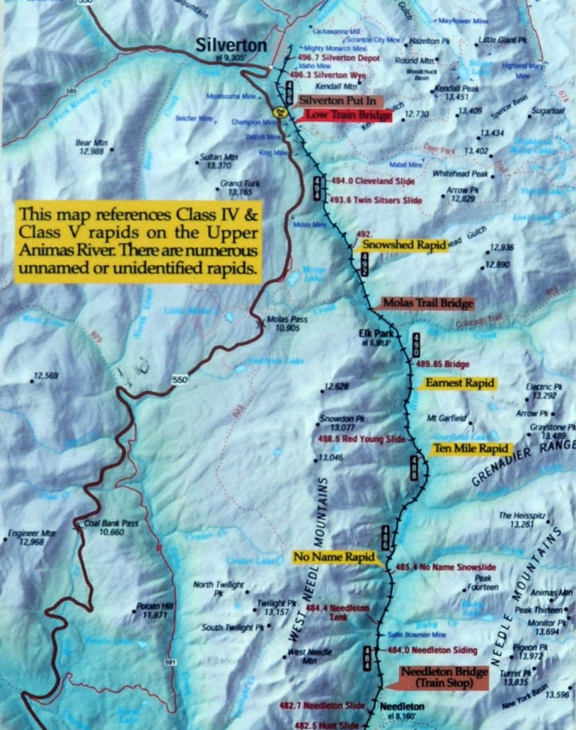
Silverton Stretch
Silverton R.A.P. 9,233 ft mm 495
Snow Shed Rapid 9,150 ft mm 492.5 Class III-IV read and run
Molas Trail Bridge 8,820 ft mm 491.2 Elk Park, Hwy 550 is 5 mi W, gain 3,500 ft
10 Mile Rapid 8,780 ft mm 487.9 Class IV-V mile 7
New Slide Rapid 8,516 ft mm 485.2 Class III-IV read and run
No Name Rapid 8,476 ft mm 485.7 Class V consequences
Needleton Bridge 8,200 ft mm 483.3
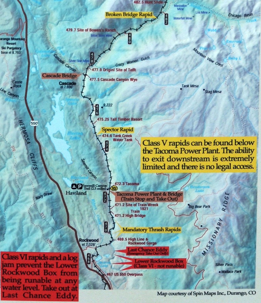
Needleton Stretch
Needleton Bridge 8,200 ft mm 483.3 Train stop
Broken Bridge 8,100 ft mm 481.7 Class IV
Cascade Bridge 7,696 ft mm 477.5 4 mile hike W, gain 1,000 ft to reach Hwy 550
Spector Rapid 7,462 ft mm 474.7 Class III
Tacoma 7,280 ft mm 472.1 Train stop
Rockwood Gorge
Tacoma 7,280 ft mm 472.1 Train stop
Last Chance 7,100 ft mm 469.2 Takeout, Hike 1.5 mile, 200 vertical feet